
Mission Overview
Map of Observations


Wavelength Coverage
Radio continuum data in a single 42 MHz bandpass centered at 1.4 GHz (20 cm wavelength)

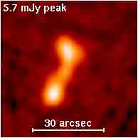
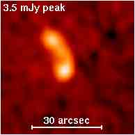
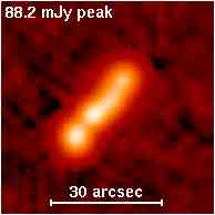
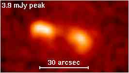
The Faint Images of the Radio Sky at Twenty-cm (FIRST) project surveyed 10,575 square degrees of the North and South Galactic Caps at a frequency of 1.4 GHz using the NRAO Very Large Array (VLA). An automated mapping pipeline was used to generate images with 1.8" pixels, a typical rms of 0.15 milliJansky (mJy), and a resolution of 5.4". At the 1 mJy source detection threshold, there are ~90 sources per square degree, ~35% of which have resolved structure on scales from 2–30". The survey covers approximately the same sky area as the Sloan Digital Sky Survey (SDSS), and 30% of the sources have optical counterparts in SDSS.
Active From
1993 - 2011
Resolution
Source Position Accuracy - <1"
Imaging - 1.8" / pixel
Northern Beam, circular Gaussian FWHM - 5.4"
Southern Beam, elliptical Gaussian FWHM - 6.4-6.8" x 5.4"
Capabilities
- Point-source detection limit 1 mJy (deeper than any previous radio survey)
- Resolution 5.4" FWHM (accurate enough to identify faint optical counterparts)
- Images are available through MAST website
- Catalogs are available through the FIRST survey website
Documentation
Search Tools


Featured Data Products


Supplemental Links
VLA First Images
Slideshow
FIRST Survey logo
Faint Images of the Radio Sky in Twenty Centimeters (FIRST). Survey Logo.
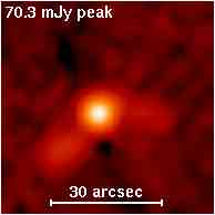
Sample FIRST Radio Image 1
Sample FIRST Radio Image 2
Sample FIRST Radio Image 3
Sample FIRST Radio Image 4
Sample FIRST Radio Image 5
Combined FIRST Radio / Optical Image Overlay
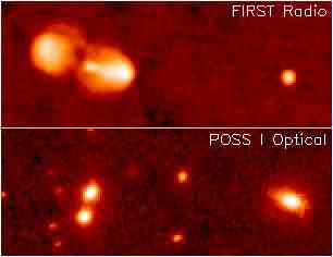
FIRST radio observations combined with POSS optical imaging data