|
|||||||||||||||||||
|
|
|||||||||||||||||||
Navigation Guide
Main FUSE Magellanic Cloud Atlas Page | Search page
Description of Data Products
- Sightline Summary Page
A "quick-look" page containing 3-color sight-line context images in the optical and the infrared, plots of selected interstellar lines, the option to view additional lines, the O VI Region of the FUSE spectrum, and the full FUSE spectrum (bin=20 pix). Clicking on the plots will bring up bigger versions of the plots. Clicking on the the link "Show page with additional interstellar lines" will redisplay the page with additional plots. Clicking on the optical and infrared images will bring up pages that show individual black and white images for each filter as well as the color composite. The optical data are from the Magellanic Cloud Emission Line Survey (MCELS) project, and the infrared images are from the Spitzer Space Telescope , with LMC data from the SAGE Survey of Meixner et al. and the SMC data from the S3MC Survey of Bolatto et al.
- FITS files
The team used FUSE data that had been reprocessed with CalFUSE 3.2 processing pipeline. When more than one observation was available, the data from all observations were co-added. All data are available for download from the search results page, via anonymous ftp and via your browser.
|
Searching Reference for spectral types and for photometry data is documented and can be located by clicking on the links in the "Spectral Type Ref" or "Photometry Ref" columns. Some of the data are the result of coadding 2 or more FUSE datasets. The column Num DS shows the number of datasets and this number is a link to a page listing the dataset names. |
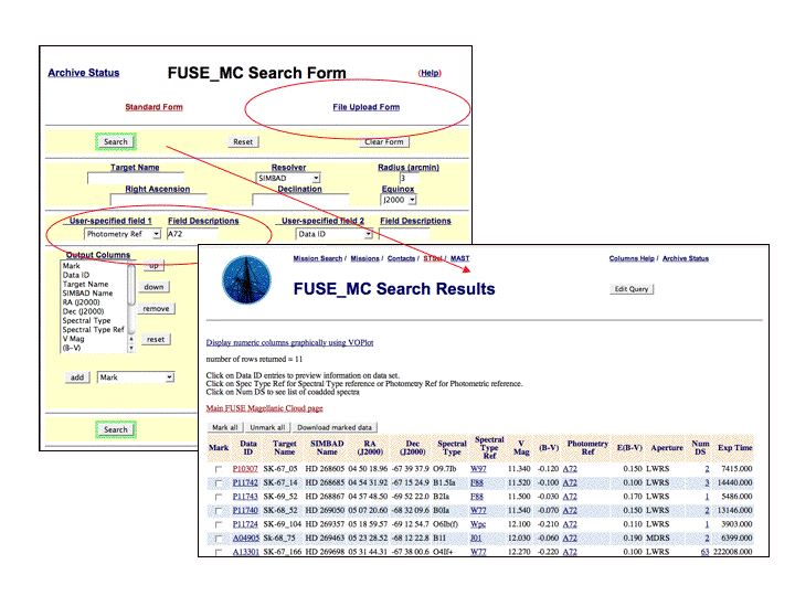
|
Displaying the Sightline Summary Page Click on Data ID to show the "Sightline Summary Page" which includes plots of selected lines, images in optical and infrared and meta data about the target. |
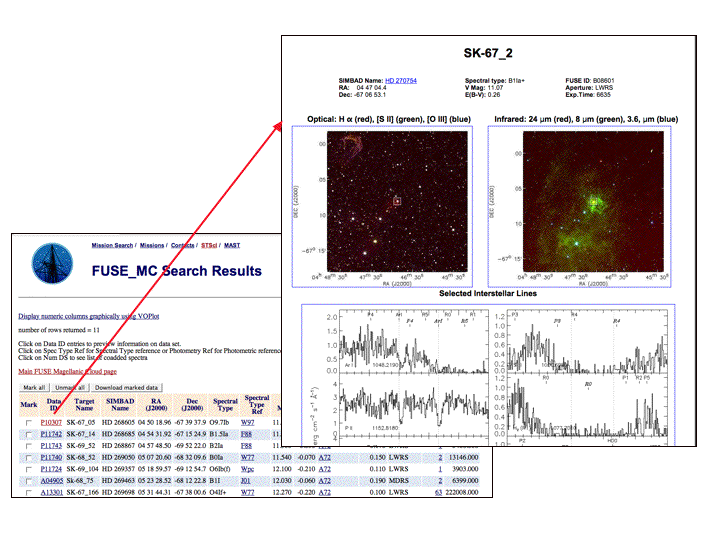
|
Link to SIMBAD from the Sightline Summary Page Click on SIMBAD name displayed on the top left of the Sightline page to bring up the SIMBAD page for that target. |
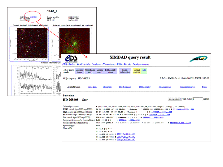
|
Display Bibliography and the FUSE Datasets for each target References for spectral types and for photometry data is documented and can be located by clicking on the links in the "Spectral Type Ref" or "Photometry Ref" columns". Some of the data are the result of coadding 2 or more FUSE datasets. The column "Num DS" shows the number of datasets. The number is a link to a page listing the dataset names. |
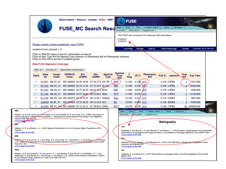
|
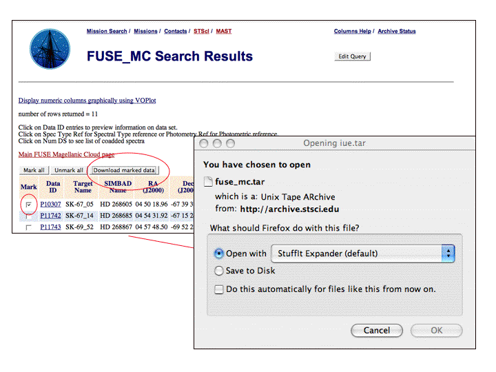
Downloading the FITS files The data used to create the atlas are available as FITS files. They can be downloaded by checking in the Mark box. If you wish to download all the data displayed in the search results page, click the "Mark all" button. Then click on the "Download marked data" button. A dialog box will appear with various options depending upon your hardware. The data are downloaded in tar or zip files and written directly to your computer.
If you prefer, you may download the data via anonymous ftp.
|
|
|
|


 Follow Us